
Every highway Logo sign is more than a traffic control device marking the location of a physical asset, it is also part of a larger digital ecosystem connected to a dynamic management engine. Each sign tells a story: of the businesses it directs travelers toward, the safety standards it upholds, the operational maintenance it requires, and the economic development it supports.
For decades, the management of Logo Programs (Specific Service Signing Programs) centered on simple placement, customer contracting, and maintenance. Today, Geographic Information Systems (GIS) are rewriting that story.
Just as GPS transformed static maps into real-time navigation, GIS is transforming static signs into living digital assets. It is not just about latitude and longitude—it is the foundation of a paradigm shift in how Departments of Transportation (DOTs) and program operators manage both fixed and mobile assets. With GIS, every sign becomes part of a powerful matrix that connects data, people, and decisions.
The Five Functions of GIS in Logo Programs
- Data Capture and Management
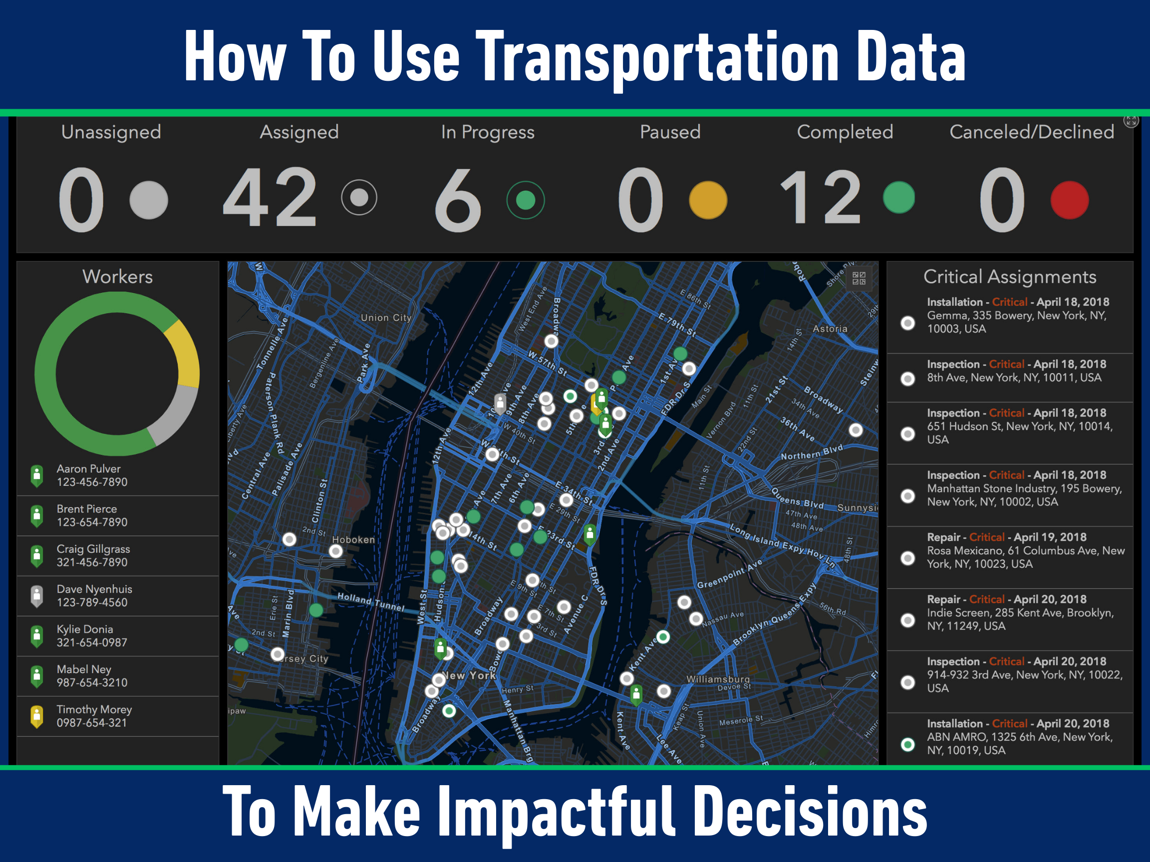
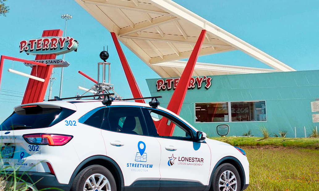
GPS made navigation personal by pinpointing your location. GIS takes it further by giving every sign its own “digital identity.” Beyond coordinates, each sign is linked to condition ratings, installation dates, traffic counts, material types, and even images from the field. This creates a living record- a digital logbook that preserves each sign’s story across its lifecycle.
- Data Analysis and Modelling
Where GPS helps you choose the quickest route, GIS helps operators choose the smartest strategy. Using traffic data, environmental models, and asset histories, GIS can predict wear-and-tear, identify high-value corridors, and flag areas of high value vacancies. Instead of reacting to problems, DOTs and contractors can make proactive, data-driven decisions about where to invest time and resources.
- Mapping and Visualization
GPS shows you the way; GIS shows you the “why.” Interactive dashboards and heat maps allow DOTs to visualize vacancy trends, monitor signs and program health, and overlay socioeconomic data to demonstrate program impact. For businesses, this means a clearer picture of where a logo placement will deliver the strongest return on investment.
- Sharing and Collaboration
GPS gave drivers a common language for directions. GIS does the same for stakeholders in Logo Programs. By connecting DOTs, contractors, businesses, and field crews through shared dashboards, everyone sees the same real-time data. A knocked-down sign, a pending approval, or an available space at an interchange no longer lives in spreadsheets- it’s visible to all, enabling faster collaboration and greater trust.
- Decision Support and Problem Solving
GPS answers “how do I get there?” GIS answers “what should we do next?” At its highest function, GIS supports strategic decision-making: where to expand a program, how to balance revenue with safety, and how to align maintenance cycles with long-term sustainability goals. It becomes the compass for solving complex problems, guiding DOTs toward smarter, future-ready programs.
A Paradigm Shift in Asset Management
Logo Programs were once seen as static- signs installed and repaired when they fall. GIS changes that perspective entirely. Signs become dynamic assets, part of a continuously updated, data-rich system that improves transparency, strengthens partnerships, and drives smarter investments.
Every sign has a story, and with GIS, those stories are no longer hidden. They are mapped, measured, and shared, fueling a more intelligent, collaborative, and sustainable future for Logo Programs.
Want to learn more or inquire about partnering with us?
